
Pedestrian Wayfinding
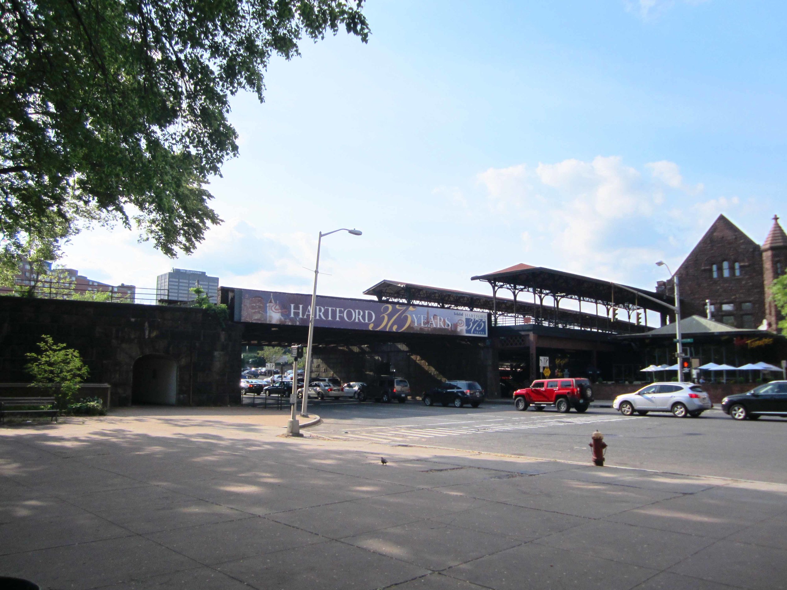
Hospitality is key to walkability. This wayfinding system was an early action item of the iQuilt Plan. The system includes 45 intersections, consisting of over 266 “Pedhead” signs and 135 “MiniMaps.” The wayfinding signs provide directions and estimated time on foot to the city’s cultural, civic, historic, and entertainment attractions. In order to minimize sidewalk clutter and reduce project costs, 90% of the “Pedheads” are placed on the back of existing pedestrian signal heads. Most dramatically, the project includes a new “Union Station” branding of the railroad trestle at the downtown gateway.

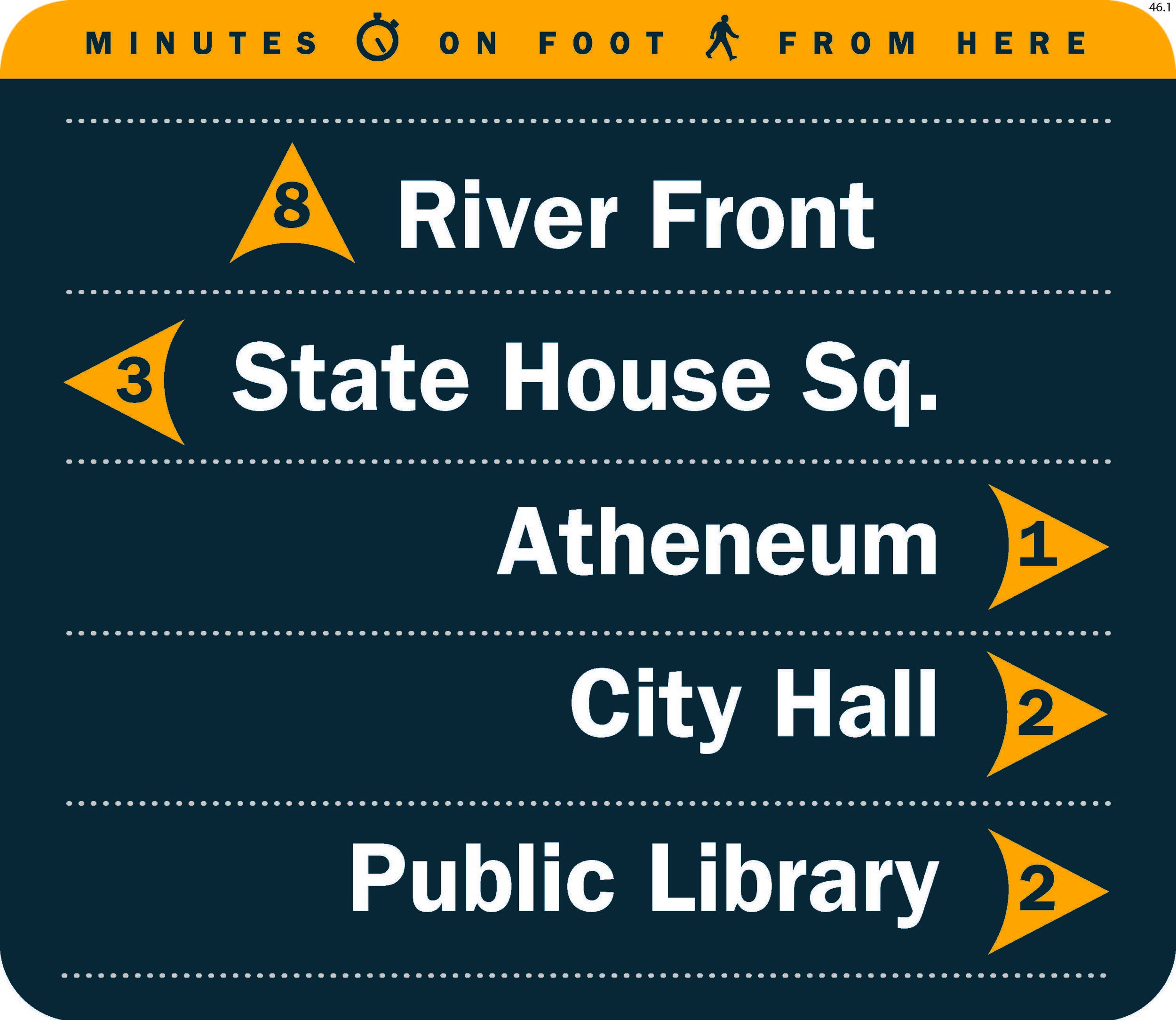
Typical pedhead and map configuration on existing infrastructure

Map of downtown wayfinding locations


While serving as a public official, JVM Studio's Jonas Maciunas coordinated the project for the City of Hartford, collaborating with a consultant on sign and map design, and managing Department of Public Works staff implementing the system. He and the Hartford Business Improvement District confirmed and identified key assets, determined which to indicate on each sign in the system, and mapped the network to ensure a consistently legible pedestrian experience.